| Parameter | Values |
|---|---|
| Coordinates | N47 22 30.9 E28 53 18.18 H 40 |
| Length, m | 75,6 |
| Type | erosion-corrosion |
| Hosting rocks | limestone |
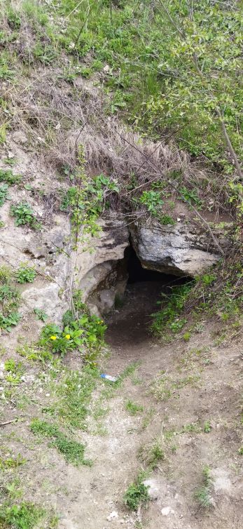
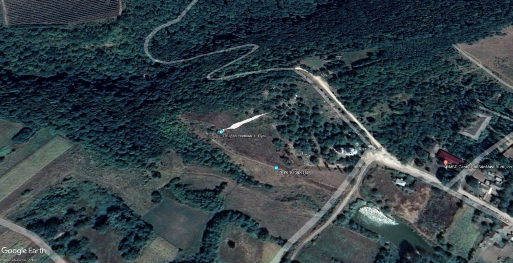
Cave Rudi is located in the Dondushan region in the vicinity of the village of Rudi, on the right bank of the Dniester river. The entrance to the cave is located on the open slope of the ravine 20 m above its swampy bottom.
The cave belongs to the subclass of karstogenic, subtype of corrosion-erosion cavities.
A complete topographical plan of this cave has been compiled, extending eastward into a narrow, impassable channel. In plan, the cave is an almost straight passage. Immediately beyond the entrance is a fairly large entrance hall, 3 meters high and 4 meters wide. This is followed by a slight constriction up to 1 meter wide and 6–9 meters high. Afterward, the passage widens again to 8 meters and gradually narrows toward the end of the cave. The height of the passage after the widening is about 2 meters, reaching up to 6 meters in places along the center. The cross-section of the passage is irregular, with the roof either flat or transitioning into a fracture. The floor is horizontal, and the walls are water-eroded.
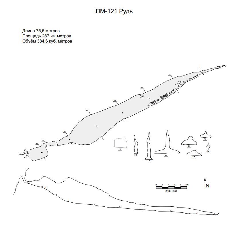
The cave is formed in grayish-white shell limestone occurring horizontally. The floor is covered with blocks, crushed stone, and clay. There is no water in the cave. The cave is known to locals, and it contains many campfire sites and various debris. It is mentioned in tourist literature (Pilat, 1968; Pronin, 2002). The cave was described by Odessa speleologists L. A. Beskrovnaya and T. K. Koloshnits on August 26, 1982.